Guanacaste (10°26′N, 85°24′W) is located in the northwest of Costa Rica (10140km2) [2]. In the northeast of Guanacaste, it is the Tempisque Basin, and in the southwest, it is the Nicoya peninsula. The first Spanish colonists arrived in Guanacaste in the early of 16th century [3]. By the 1800s, they began to establish some large-scale farms [4] and since then the tropical forests degraded gradually. In the mid of 1800s, the increasing of population, the demands for land increased drastically [3]. From 1930s onwards, the landless was forced by survival pressure and migrated from central Costa Rica to surrounding areas, especially to Guanacaste [5]. The expansion of road network aggravated this process, as well as the colonization policies [6].

Figure 1. Study Area
From 1950s, the global consumption of beef increased [7]. Costa Rica became a main beef exporter due to its own agricultural-industrial structure and almost 40% of all cattle in Costa Rica were fed in Guanacaste [8]. Until the early of 1970s, the total volume of beef export in Costa Rica researched a peak; and most of the forests in Guanacaste disappeared at the time. By that time, beef industry was not only the primary source of income but also the main driver leading to deforestation.
However, the deforestation emerged a favourable turn in the middle of 1980s. Beef industry initiated to collapse, because the global per capita beef consumption fell. Most of Costa Rican abandoned cattle ranching, and transferred the way of land use for more income. In addition, the government made a series of policies to restrict timber extraction and land clearing and encourage protection and restoration forests [9]. Therefore, by the year 2010, the total area rate of forests in Guanacaste was up to 54.1%, whereas it was 26.5% in 1979. Costa Rica is a considerably successful case in forest restoration. Thus the research of rules and trends of deforestation and restoration in Guanacaste can provide decision maker some suggestion and help in other forests. Meanwhile, this project also discussed the recovery of forest function and spatial structure in this area.
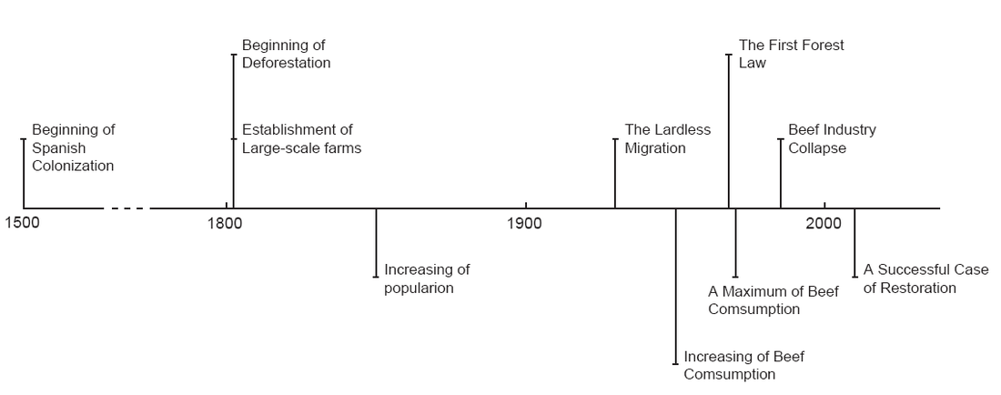
Figure 2. The Timeline of Land Use History in Costa Rica
